ViewPoint Geography
MAP ROOM
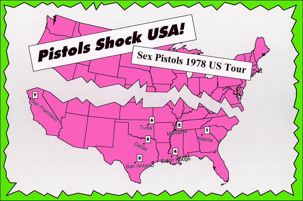
Sex Pistols 1978 US Tour
A chaotic slam through the South and one final blast on the West Coast — the band's first and last tour of the states.
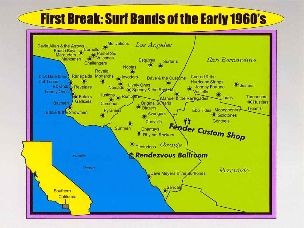
First Break: Surf Bands of the Early 1960's
Sun, ocean waves, Fender guitars, and the Rendezvous Ballroom anchored the first wave of surf music in Southern California.
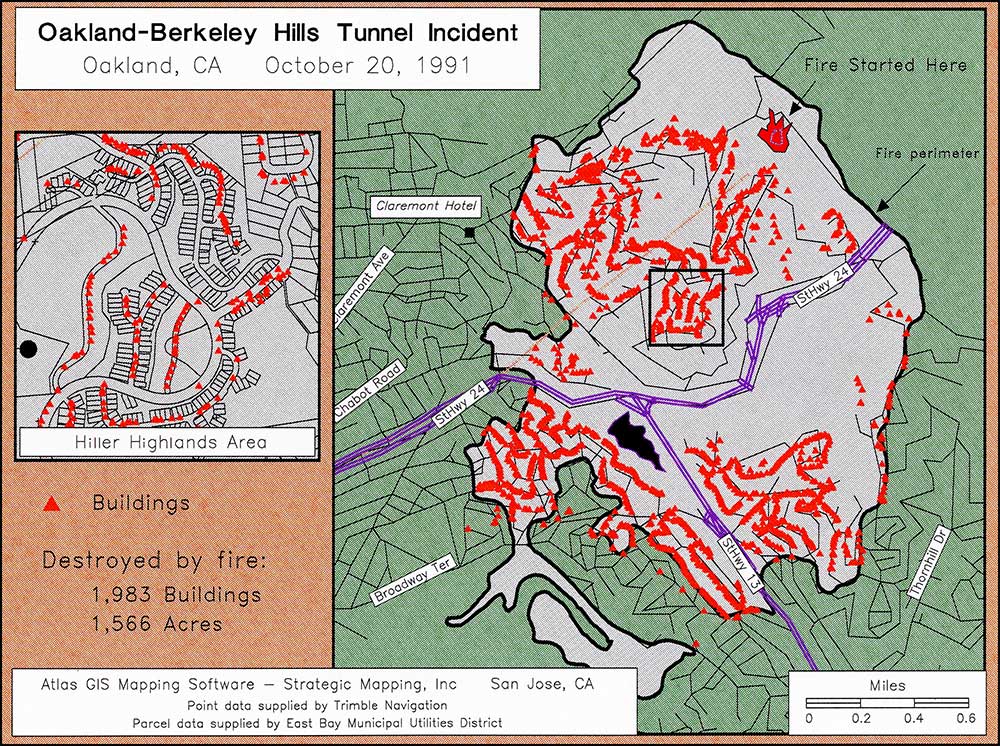
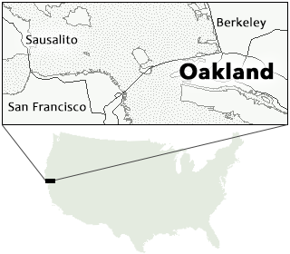
Oakland - Berkeley Tunnel Fire 1991
Lawrence was on the scene the day after the fire to create maps to assist the fire departments in managing the impacts.
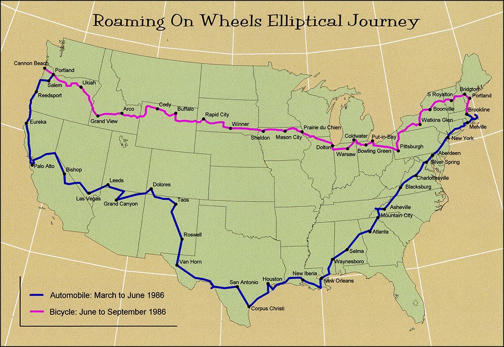
Auto and Bike Tour of America 1986
After earning his geography masters degree, Lawrence explored America on four-wheels and two-wheels.
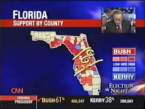
VoteVision on CNN
Custom map system for broadcast, designed by VG, allows reporters to interact with real-time vote count maps.
Election Results Map Animation
A time-lapse movie created from VoteVision snapshots showing incoming vote returns over a 10-hour period.
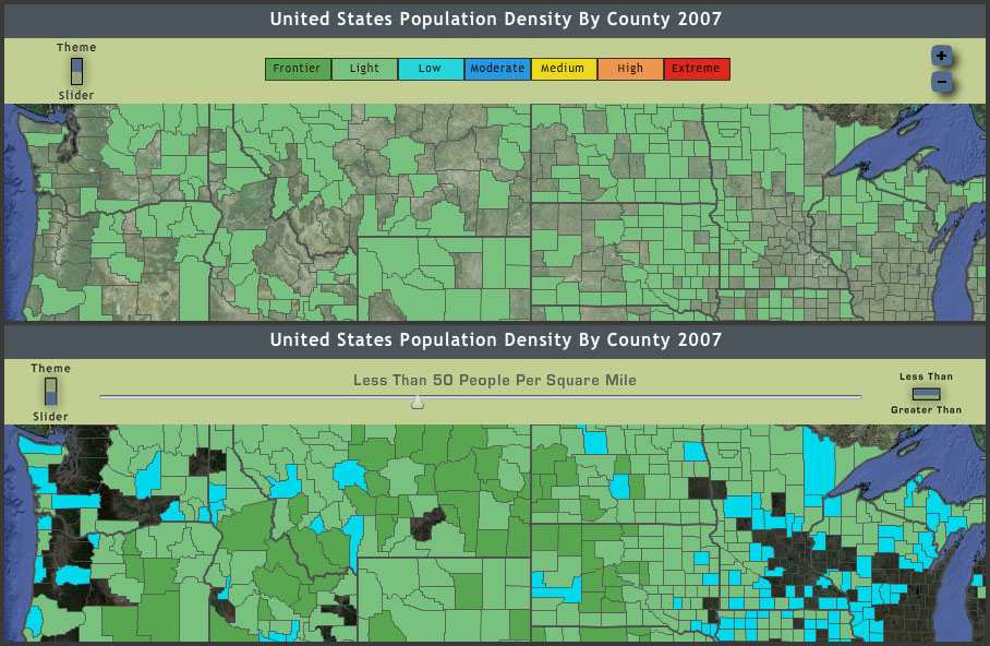
US Population Density Interactive Map
Population density website map with tools for viewing the data by theme category or using a slider.
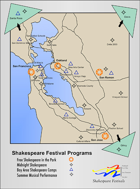
San Francisco Shakespeare Festival Programs
The SF Shakespeare Festival runs a variety of programs around the greater Bay Area.
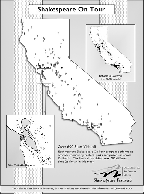
San Francisco Shakespeare Festival Tour
The SF Shakespeare Festival brings the Bard to many different audiences around California.
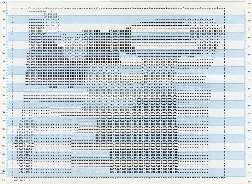
Dot-Matrix Choropleth Map of Oregon
Map created with ESRI's Automap II software in 1985. Submit stack of punch cards, return the next day to pickup printout.
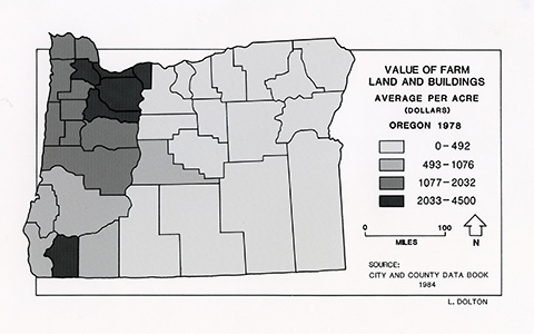
Hand-Printed Cartography Studies: Oregon
Choropleth map of Oregon counties made with screens.
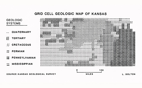
Hand-Printed Cartography Studies: Kansas
Grid cell map using type characters to define data regions.
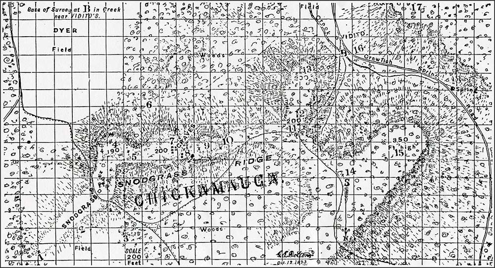
Hand-Drawn Civil War Map
Map of the 1863 Chickamauga battlefield drawn by Lawrence's great-great-grandfather, George E. Dolton, for his regiment.
All maps by Lawrence Dolton
(except "Hand-Drawn Civil War Map" by George E. Dolton)